


Lake Fishing, 29F Lake St. Clair, Easy-to-Read, Large Print, Waterproof Paper, Tear Resistant, Printed on Two Sides, 2 Charts in 1, NOAA Charts

 4.7 (100 items)
 Limited Time Sale
$23.39 cheaper than the new price!!
Free cash-on-delivery fees for purchases over $99
Product details
| Management number | 214525441 | Release Date | 2026/04/12 | List Price | $15.60 | Model Number | 214525441 | ||
|---|---|---|---|---|---|---|---|---|---|
| Category | |||||||||
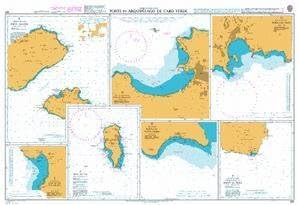
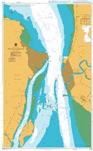
Complete coverage of Lake St. Clair on side “A” with detailed insets of the Detroit River entrance and the entrance to the Clinton River. Side” B” has complete coverage of the St. Clair River north to Lake Huron with a detailed inset of Port Huron. Nautical information derived from 3 NOAA Charts; #14852, #14853 & #14850. This LARGE PRINT Lake Chart details all of the Major Fishing Areas and pinpoints dozens of specific areas for the major species caught in the area. (Large and Smallmouth Bass, Yellow Perch, Walleye, Muskie, Northern Pike, Salmon & Trout). Many areas have GPS positions. In addition many popular restaurants are listed as well as popular Boat Ramps. If youÕre serious about fishing Lake St Clair, this is a “Must Have”. Lake St Clair is ideal for fishing and boating, so why not use the best nautical chart around? Our Lake St Clair map has local fishing information from the pros! Nobody else has the level of detail we offer. Complete coverage of Lake St Clair on side “A” with detailed insets of the Detroit River entrance and the entrance to the Clinton River. Side” B” has complete coverage of the St Clair River north to Lake Huron with a detailed inset of Port Huron. Nautical information derived from 3 NOAA Charts; #14852, #14853 & #14850. This large print Lake St Clair map details all of the major fishing areas and pinpoints dozens of specific areas for the major species caught in the area. (Large and Smallmouth Bass, Yellow Perch, Walleye, Muskie, Northern Pike, Salmon & Trout). Many areas have GPS positions that you can easily input into your GPS unit. In addition many popular Lake St Clair restaurants are listed as well as popular Boat Ramps. If you’re serious about fishing Lake St Clair, this is a “Must Have” for the boat, and for framing to keep in your home or office. Navigation chart is 25″ X 38″. WGS84 – World Mercator Datum. Easy-to-Read Large Print Waterproof Paper Tear resistant Paper (Indescribable) Printed on two sides
- Complete coverage of Lake St. Clair on side “A” with detailed insets of the Detroit River entrance and the entrance to the Clinton River.
- Side” B” has complete coverage of the St. Clair River north to Lake Huron with a detailed inset of Port Huron.
- Nautical information derived from 3 NOAA Charts; #14852, #14853 & #14850.
- This LARGE PRINT Lake Chart details all of the Major Fishing Areas and pinpoints dozens of specific areas for the major species caught in the area.
- (Large and Smallmouth Bass, Yellow Perch, Walleye, Muskie, Northern Pike, Salmon & Trout).
| UPC | 740399002963 |
|---|---|
| Color | Blue (predominant) |
| Map Type | Navigational, Recreation |
| Brand Name | Waterproof Charts |
| Paper Size | 25" X 38" |
| Manufacturer | Waterproof Charts |
| Paper Finish | Coated, Matte |
Charts & Maps


Correction of product information
If you notice any omissions or errors in the product information on this page, please use the correction request form below.
Correction Request Form