


Standard Navigation, 60 Fishers Island Sound

 4.5 (96 items)
 Limited Time Sale
$26.34 cheaper than the new price!!
Free cash-on-delivery fees for purchases over $99
Product details
| Management number | 214525529 | Release Date | 2026/04/12 | List Price | $17.56 | Model Number | 214525529 | ||
|---|---|---|---|---|---|---|---|---|---|
| Category | |||||||||
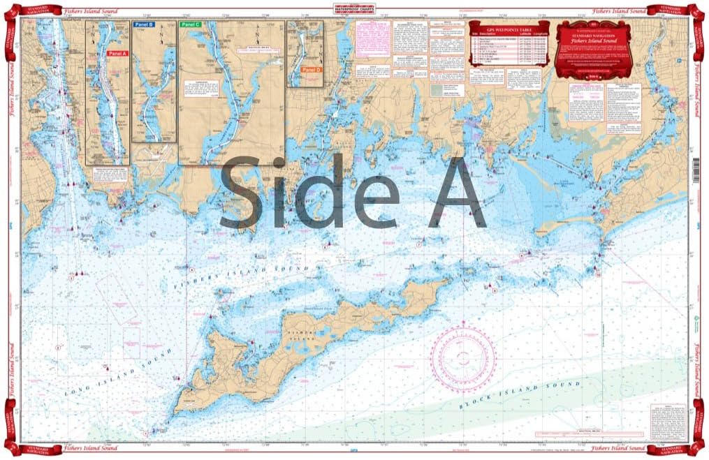
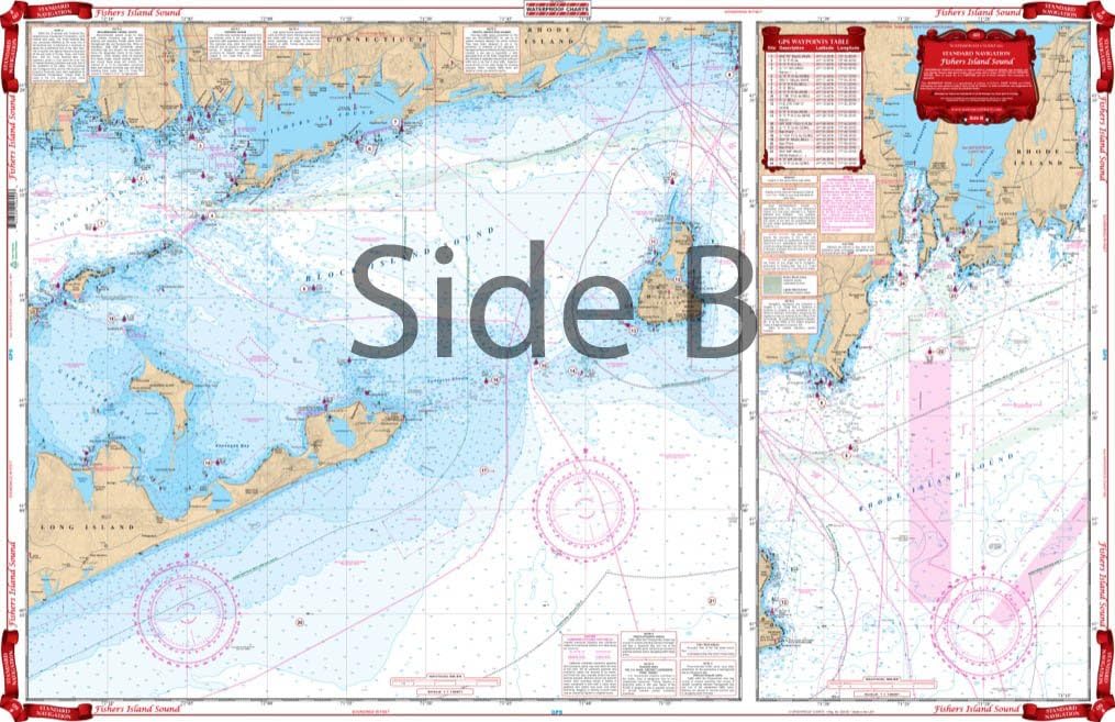
A great combination of 5 government charts. This chart provides good detail from Watch Hill west through Fishers Island Sound to the Thames River and upriver to north of Bartlett Point. The chart includes the Pawcatuck River, Stonington, Mystic Harbor, Noank and New London Harbor, and all of Fishers Island. The reverse side covers the Block Island Sound area including Plum Island and Gardiners Island, and Block Island west to Niantic and east to Newport, Rhode Island. Includes information from NOAA Charts: #13218, #13205, #13214, #13212, and #13372. Chart is 25" X 38". WGS84 - World Mercator Datum.
- Two Sided
- Foldable
- Tear Resistant Synthetic Paper (Hop-Syn) 5 PP Tree Friendly
| Material | Polypropylene |
|---|---|
| Brand Name | Waterproof Charts |
| Part Number | 60 |
| Manufacturer | Waterproof Charts |
Charts & Maps


Correction of product information
If you notice any omissions or errors in the product information on this page, please use the correction request form below.
Correction Request Form